O aparecimento do Pico e a forma dos seus vulcões
06/04/2022
From a geotectonic perspective, the archipelago sits at the "Azores Triple Junction," meaning it lies between the North American, Eurasian, and African lithospheric plates. Scientists refer to this area as the Azores Microplate, delimited by the 2000-meter bathymetry, covering an area of 5.8 million km².
Geographical and Geotectonic Framework
Formation of the Azores Microplate
Around 36 million years ago, the migration northward of the plate junction began, leading to its current position. It may have originated as a hot spot that evolved into a highly dynamic area with several faults causing numerous earthquakes and episodes of magma rising to the surface. In this region, magma retained in the mantle, in constant movement due to convection currents, ascends to the crust through fissures and faults, more likely and in greater quantity than other areas. However, this magma's ascent might not always lead to an eruption but could accumulate.
Different Types of Magma
The mantle's composition, the source of magma, consists of Fe and Mg silicates, ultra-basic rocks. The oceanic crust is chemically more basic than the continental crust, resulting in more basic magmas and hence fluid lava eruptions. Typically, in oceanic crust zones, volcanic magma will always be basic.
Emergence of Pico and the Shape of its Volcanoes
The Faial and Pico islands emerged from a tectonic fracture oriented ONO-ESE – known as the Faial Pico Fault, a transform fault structure that extends over 350 km from the Mid-Atlantic Ridge (MAR) to an area of flat bottoms located south of the Hirondelle Trench. The formation of Pico Island began 300,000 years ago, with increased fissural and submarine lava productivity.
The Topo-Lajes volcanic complex includes the Topo volcano. Today, it covers an area of about 18 km² and stands at a height of 1,022m. It is a shield volcano, essentially resulting from overlapping lava flows. As the lava is fluid, of the pahoehoe type, it spreads far from the crater, with its area greater than that of the Stratovolcano of Montanha do Pico.
With the evolution of activity, the volcanism becomes progressively more explosive, manifested by Strombolian eruptions around the volcano. An estimated 5,000 years ago, the Topo volcano activity likely ceased (França et al., 2005). It presents two important depressions: (1) the Caldeira de Santa Bárbara, slightly tilted to the south, and (2) the Terras Chãs.
[...The content continues in a similar manner...]
 Figure 3- Vulcão do topo, vulcão de lavas básicas, extremamente erodido. O lado direito apresenta-se com uma escarpa de falha, em que a sua queda e deslize deu origem à caldeira de Santa Barbara.
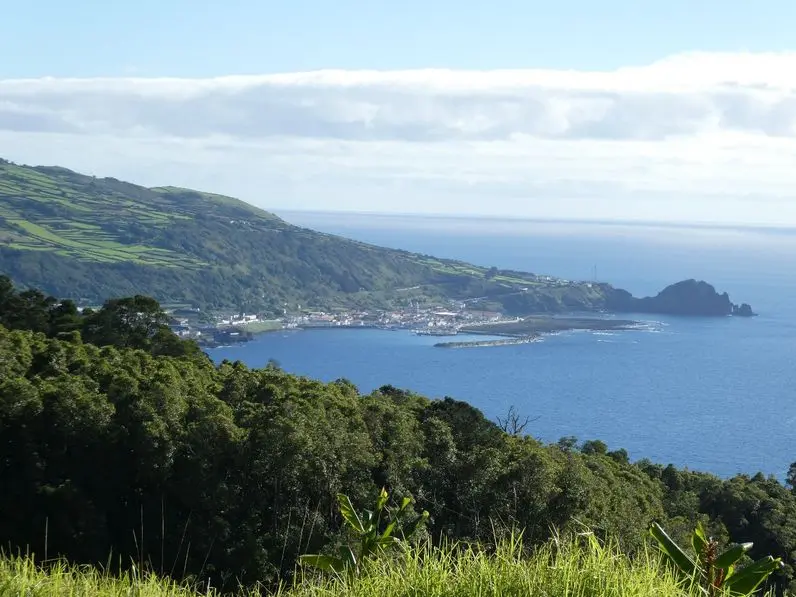 Figure 1- Vila das Lajes, erigida sobre uma escoada de lavas básicas e do lado direito um cone vulcânico, fortemente erodido.
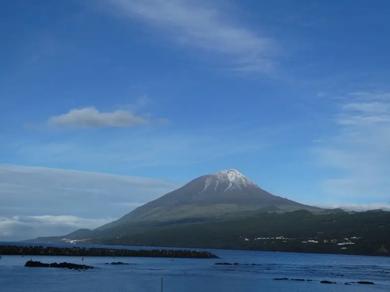
 Figure 2- No lado direito temos um pequeno cabeço que originou o mistério de São João, ao centro o estratovulcão e mais à direita um pequeno cabeço que originou o mistério da Silveira.
The content continues with similar descriptions and explanations about the geological formations and volcanic activities in the region, focusing on specific volcanic events and their impact on the landscape.
João Pelica
Professor